Summary
| DATE | 09/11/1852 |
| ORIGIN TIME | 04:25:00 UTC |
| LOCATION | 53.020 -4.300 |
| DEPTH | 24.0 km |
| MAGNITUDE | 5.3 ML |
| LOCALITY | CAERNARVON |
| DATE | 09/11/1852 |
| ORIGIN TIME | 04:25:00 UTC |
| LOCATION | 53.020 -4.300 |
| DEPTH | 24.0 km |
| MAGNITUDE | 5.3 ML |
| LOCALITY | CAERNARVON |
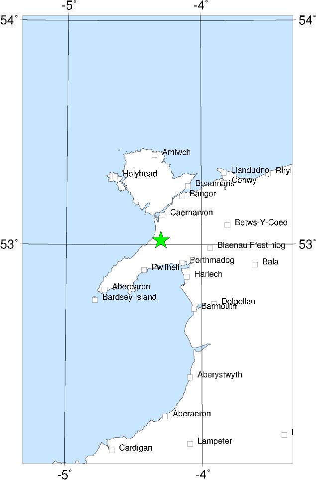

Some confusion has been caused by this earthquake - traditionally the epicentre has been placed somewhere in the middle of the Irish Sea, or even quite close to Dublin. It seems clear, though, that the epicentre was actually in Caernarvon Bay. The extent of the felt area is very great, and is roughly delimited by Galway, Glasgow and London. There was little damage, and what there was was scattered over a wide area from Dublin to Shrewsbury, without any concentration of high intensities in the epicentral area. This is almost certainly indicative of a relatively deep focus.
The event is closely comparable to the 19 July 1984 Lleyn earthquake.
Sources: Musson et al (1986a).