Summary
| DATE | 24/05/1382 |
| ORIGIN TIME | 05:30:00 UTC |
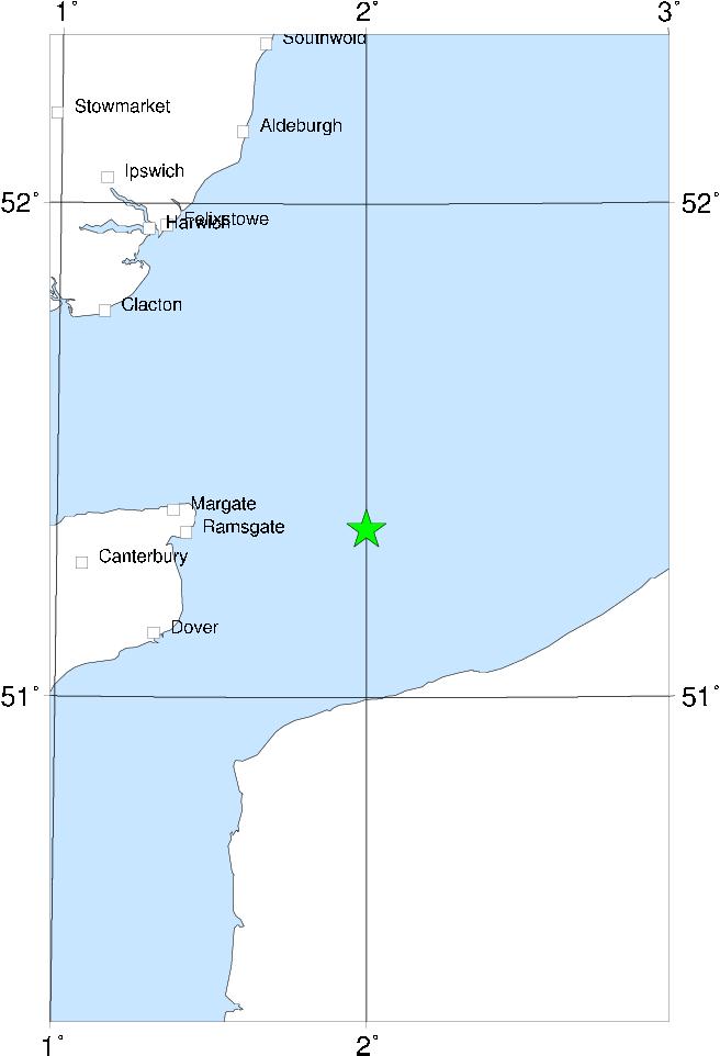
| LOCATION | 51.340 2.000 |
| DEPTH | km |
| MAGNITUDE | 5.0 ML |
| LOCALITY | DOVER STRAITS |
| DATE | 24/05/1382 |
| ORIGIN TIME | 05:30:00 UTC |
| LOCATION | 51.340 2.000 |
| DEPTH | km |
| MAGNITUDE | 5.0 ML |
| LOCALITY | DOVER STRAITS |

Aftershock of the above; caused effects on water in Kent harbours and probably exceeded 4 ML.