
Haiti earthquake | Magnitude 7.0 | 12 January 2010
Last update 17.43 02/03/2010
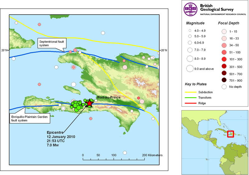
| Date | 12 January 2010 |
|---|---|
| Origin time | 21:53 10s UTC |
| Lat/Long | 18.46° North / 72.53° West |
| Depth | 13 km |
| Magnitude | 7.0 Mw |
| Locality | Haiti, 25km WSW of Port-au-Prince |
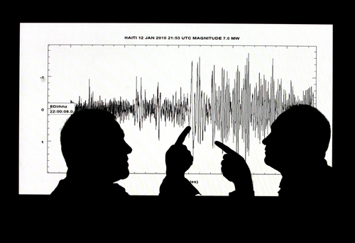
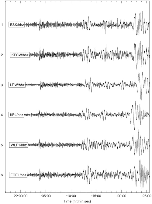
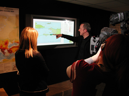
Scientists at the British Geological Survey were alerted by their automatic earthquake location software 10 minutes after the earthquake struck Haiti. The seismic waves from the earthquake took 10 minutes to reach their seismic monitoring stations in the UK. Since then their seismologists have been examining the data and investigating why Haiti was struck by an earthquake of this size.
Dr Roger Musson Seismologist at the British Geological Survey said 'The situation In Haiti is similar to the San Andreas Fault in California in that two plates are sliding past one another. The fault in this case is called the Enriquillo-Plantain Garden fault. This fault has been locked for the last 250 years gradually accumulating stress which has now been released in a single large earthquake.'
There has been a serious loss of life in the Port-Au-Prince area which has been devastated by the initial 7.0 earthquake, approximately 15 km to the south-west of the city.
Aftershocks continue to shake the country
The sustained sequence of large aftershocks has hampered rescue attempts of those injured and caused further damage to buildings. This is the largest earthquake to affect the area for over two centuries.
Dr Brian Baptie Seismologist at the British Geological Survey said 'Earthquakes of this size always have aftershocks that can last for many weeks. These always punch above their weight, affecting buildings that have already been damaged and hampering relief efforts.'
Dr David Kerridge Head of Earth Hazards at the British Geological Survey said 'With an earthquake of this size and the mountainous terrain there is a strong possibility of landslides which may have caused many causalities in more remote parts of the island. Due to disruptions in communications the full extent of the disaster might not be clear for a few days.'
Tectonic activity in the Caribbean
The Caribbean is an area of considerable tectonic complexity and almost every sort of tectonic activity can be observed within relatively short distances. Haiti lies close to the northern edge of the Caribbean plate, which is moving eastwards with respect to the North American Plate further north at around 2cm per year.
Onshore, there are several important fault systems that accommodate the movement between the Caribbean and North America. Two distinct strike-slip fault systems are present on land (Mann et al., 1995). It is likely that the 12 January 2010 earthquake occurred in the Enriquillo-Plantain Garden Fault Zone (EPGFZ). This is a left-lateral fault zone that runs roughly east-west along the southern peninsula of Haiti, continuing offshore to Jamaica in the west. It is thought to form the southern boundary of the Gonave microplate (Mann et al., 1995). There is evidence for both vertical and lateral movement on the fault. Dixon et al (1998) estimate the slip rate on this fault to be about 8 mm/yr. Despite the tropical climate, which accelerates weathering, the landscape features associated with the EPGZ are clear and Mann et al. (1995) interpret this as evidence of significant activity on this fault.
Most of the aftershocks have occurred to the west of the mainshock in the Mirogoane Lakes region. This is a pull-apart basin formed by a 5 km step over in the EPGFZ (Mann et al., 1995). The aftershocks approximately map out the earthquake rupture plane, and suggest that the length of the rupture was around 70 km.
Historical seismicity
Haiti has a well-documented history of large, destructive earthquakes. Historical seismicity in southern Haiti is probably related to the EPGFZ. Large earthquakes occurred in 1701, 1751, 1770 and 1910 (Dixon et al., 1998 and references therein). The earthquake of 9 November 1701 probably occurred between Gonave Island and the southern peninsula. Port-au-Prince was not yet founded but Taber (1922) notes that there was some severe damage in and around Léogâne and that the road leading along the shore from Léogâne to Petit Goâve sank into the sea.
In 1751, a major earthquake in southern Hispaniola destroyed the recently founded Port-au-Prince and caused severe damage to buildings on the neighbouring plains (Taber, 1922). The magnitude of this event may have reached 8.
A major earthquake on 3 June 1770 caused destruction in a zone extending from Croix de Bouquets in the east to Miragoâne in the west (Taber, 1922). There were also numerous earthquake-induced landslides in the mountains, which dammed rivers as well as reports of a tsunami.
Contact Brian Baptie for further information.
References
Dixon, T.H., Farina, F., DeMets, C., Jansma, P., Mann, P. and Calais, E., 1998. Relative motion between the Caribbean and North American plates and related boundary zone deformation from a decade of GPS observations, J. Geophys. Res., vol 103, pp 15157-15182.
Mann, P., Taylor, F.W., Edwards, R.L. and Ku, T.-L., 1995. Actively evolving microplate formation by oblique collision and sideways motion along strike-slip faults: An example from the northeastern Caribbean plate margin, Tectonophysics, vol 246, pp 1-69.
Sykes, L.R., McCann, W.R. and Kafka, A.L., 1982. Motion of Caribbean plate during the last 7 million years and implications for earlier Cenozoic movements, J. Geophys. Res., vol 87, pp 10656-10676.
Taber, S., 1922. The seismic belt in the Greater Antilles, Bulletin of the Seismological Society of America, vol 12, 199-219.
- A Comparison of the Folkestone and Market Rasen Earthquakes
- Seismogenesis and State of Stress in the UK
- Monitoring Volcanic Eruptions Using Interferometry
- Particular events
- Are yesterday's earthquakes tomorrow's disasters?
- Creating 'virtual seismometers' deep inside the Earth
- Is earthquake activity related to the Moon or Sun?
- Is earthquake activity increasing?
- Disaster May Trigger Area Temblors in Coming Decades, The Wall Street Journal
- Steve Connor: Island is cut across with fault lines, The Independent
- Today: Wednesday 13th January , BBC News
- Haiti Earthquake Disaster Little Surprise To Some Seismologists, Scientific American